Missouri Supreme Court blocks gerrymandered map in major loss for Republicans
Published in News & Features
The Missouri Supreme Court on Thursday blocked the state’s gerrymandered congressional map from being used in the November election, a seismic ruling that halts a Republican attempt to force Kansas City’s longtime congressman out of office.
The unanimous decision found that Republican Secretary of State Denny Hoskins was wrong to reject a campaign seeking to strike down the map, called HB 1. The ruling also makes it explicitly clear that the new map cannot be used in November.
“The secretary and all of those acting in concert with him are restrained and enjoined from implementing, using, or mandating the use of the congressional redistricting in HB 1 for the November 2026 general election,” the court ruled on Thursday.
The court ruled that the campaign seeking to strike down the map must appear on the Nov. 3 ballot. The map can only be used if voters approve it, the court said.
The ruling hands a key loss to President Donald Trump amid a bitter fight for control of Congress this year. Missouri Republican lawmakers redrew the map last year under pressure from the Trump administration.
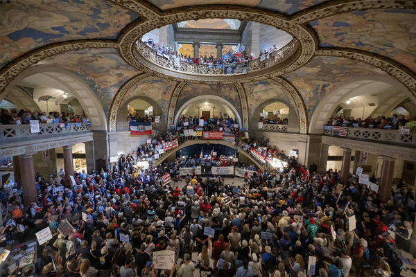
But hundreds of thousands of Missourians fought back. They used a referendum, a mechanism for direct democracy that allows citizens to challenge laws, and collected more than 305,000 signatures to force a statewide vote on the map.
Thursday’s ruling marked the culmination of that fight, making Missouri the first state in the country to use a referendum to block a Trump-backed map. The campaign survived a series of attacks from state officials and months of court battles to reach the Nov. 3 ballot.
Now, the decision is poised to scramble the upcoming November election. Missouri already held primary elections using the new map and it was not immediately clear on Thursday how state officials would react to the ruling ahead of November.
The map split Kansas City’s voters into three Republican-leaning districts. The goal was to oust Democratic U.S. Rep. Emanuel Cleaver and allow Republicans to pick up seven of Missouri’s eight congressional districts.
Under the map, Cleaver’s 5th Congressional District stretched east from Kansas City to the rural cities and towns spread across mid-Missouri. The map used Troost Avenue, the city’s historic symbol of racial segregation, as a dividing line between the 4th and 5th Districts.
The map, barring any major changes, will revert back to the boundaries lawmakers approved in 2022, bolstering Cleaver’s chances of reelection. Cleaver, Kansas City’s first Black mayor, has represented the city’s urban core in Congress since 2005.
_____
©2026 The Kansas City Star. Visit kansascity.com. Distributed by Tribune Content Agency, LLC.

Comments